Many years ago when I was a student at Mount Allison University in Sackville, New Brunswick, I spent two of my summers working at Keltic Lodge in the Cape Breton Highlands. Cape Breton is an island connected by a causeway to the province of Nova Scotia. Today it’s considered as one of the world’s ‘go to’ places to visit. I am not surprised that it has gained this honour because it definitely deserves to be on that list. However, when my university friend whose family came from the Parrsboro Shore on the mainland of Nova Scotia called it ‘a little Cape Breton’, I was doubtful. Nothing could match what I had seen and experienced for those two summers I spent in Cape Breton. So after fifty years, I decided to check out what she said for myself.
At the same time, I wanted to learn more about why this area has recently won the distinction of becoming a UNESCO site making it another of our world’s wonders needing to be protected. For starters, it can visibly trace its history back to prehistoric times and beyond. Yes, it’s where you can find dinosaur remains and other fossils in abundance. It’s not only a geologist’s delight but also one for our young dinosaur lovers.
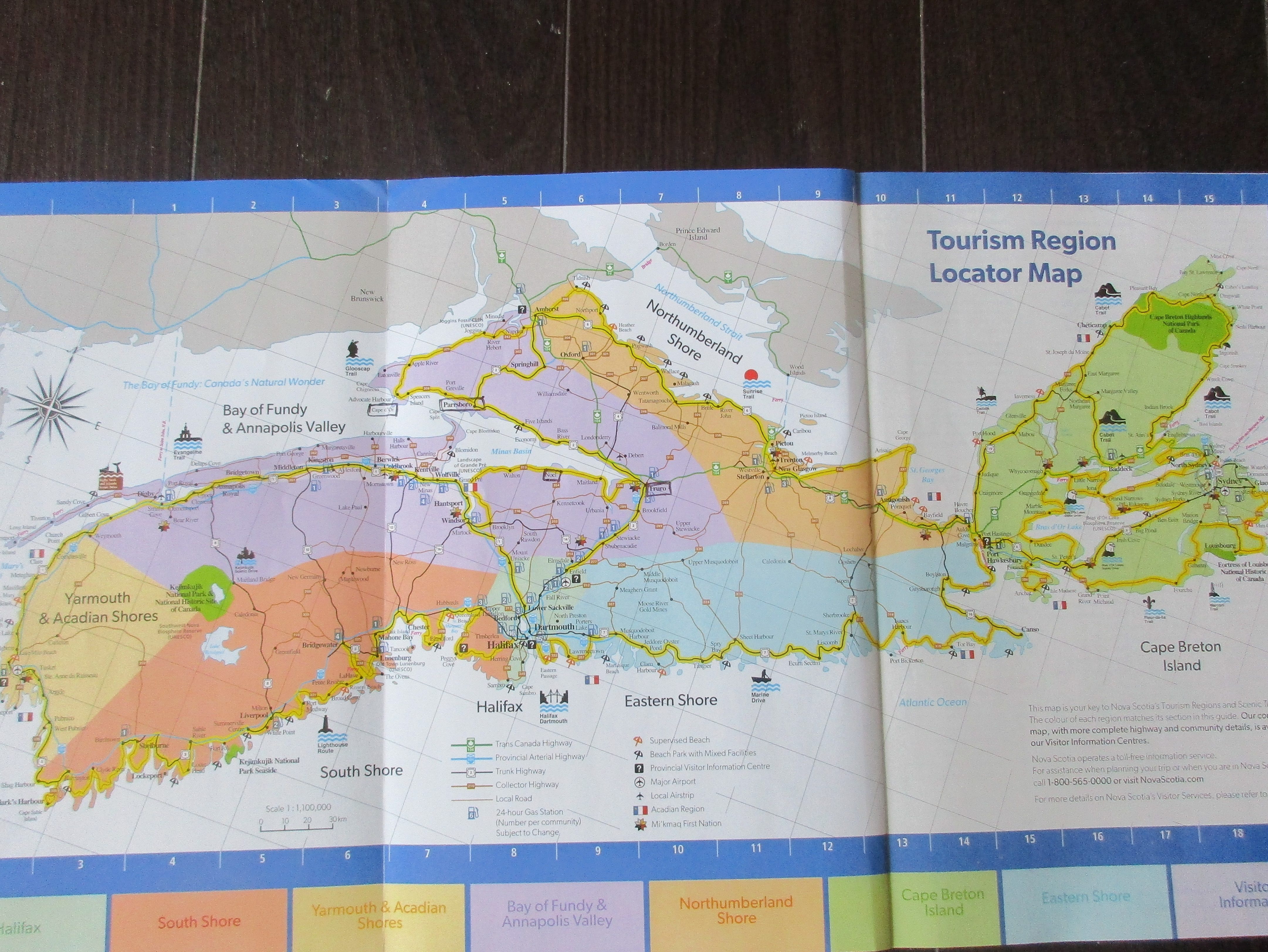
Today this area stretching from Truro to Cape Chignecto is called the Fundy Geopark. The village of Parrsboro, the Geopark, and surrounding area form a large chunk of land close to our neighbouring province of New Brunswick separated only by the Bay of Fundy. This map of Nova Scotia shows New Brunswick, the gray bit to the north, Prince Edward Island just to the right of that, and finally Cape Breton, the green area on the right.
I am going to digress here a little bit to explain how vulnerable this area is to the effects of our changing climate. NB and NS are connected by the Isthmus of Chignecto which is a narrow strip of low lying marshland. It’s not surprising that it is being slowly eroded by our frequent wind and rain storms which get worse every year. If some kind of action isn’t taken soon, all of Nova Scotia including Cape Breton could easily become an island separating us from the rest of Canada.
For me the best way to travel around Nova Scotia is to stick to the scenic routes to really see what this province has to offer and to get a sense of its history. The day I set out from my home in the Valley, on the western side of the province facing the Bay of Fundy, it was sunny. As I went further north and had hooked on to the scenic highway 214 commonly known as the Noel Shore, the skies began to darken and within minutes I heard the unmistaken sound of hailstones hitting the roof of my car, instantly followed by a deluge of rain which brought me to a dead halt. Thank goodness, it didn’t last long and by the time I reached Noel, the sun had reappeared.
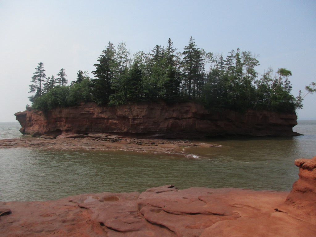
Spotting an eye-catching sign naming a place called Burntcoat Head, a place I had never heard of before, I decided to stop. Here I got my first glimpse of the unique rock formations, commonly called ‘flower pots’ which the Bay of Fundy is famous for in the southern part of New Brunswick. Unfortunately, the tide was on its way in so I couldn’t walk the ocean floor to look for fossils. Signs were posted everywhere reminding us to not go down the steep stairs since the tide comes in so quickly and can leave you stranded.
My next stop was the town of Truro where I was going to stay for a night with another Mount Allison friend. We had five years of catching up to do. The following morning, she took me on quick tour of the town which included a visit to Victoria Park, a 3,000 acre natural park in the centre of town. As we walked up the stairs to see the two waterfalls, I was reminded of the fun times I had when my father took me, my brother, and my grandmother in his old black plymouth for a Sunday picnic to this wonderful park.
Leaving Truro the next day, I had to get back on the main highway to connect to Highway 2 now known as the Glooscap Trail. This road will take you through several small villages of note with lovely views of the Minas Basin an adjunct of the Bay of Fundy. The first village, unfortunately, happens to be Portapique. For those who don’t know about Portapique, two years ago this community was literally attacked by a mad gunman, dressed up in police uniform and driving a police car who went on a rampage killing 22 people. Today, it is reported as one of the worst crimes in Canadian history.
The next village is Bass River famous for the Bass River Chair Co. which manufactured and shipped caned-back chairs worldwide until its closing in 1989 after a succession of disastrous fires. One of the original buildings is still there operating as a General Store along with a small museum where you can find many pieces of their fine furniture.
A little further on is the Dutchman’s Cheese Farm in the village of Economy where you can buy the owner’s famous ‘dragon’s breath’ cheese. As the road veered closer to the water, I spied the scenic Five Islands in the distance. Here you will find a popular and well equipped Provincial Park for RV owners and campers providing all the amenities for outdoor living, a spectacular view of the islands, and another opportunity to walk the ocean floor…if the tide is out! Yes, walking on the beaches and looking for fossils are activities around the Bay of Fundy dictated by its tides.
Furthermore, this is Mi’kmaq land as much of Nova Scotia once was. Legends galore exist with their tales of how much of what we see today was created by Glooscap, their Chief. In the distance, you can see Cape Blomidon on the other side of the Basin where he resided. Legend has it that the Five Islands grew from the sticks that he threw at a beaver damming up his medicine garden. He trapped the beaver and turned him into a lump of gold. Such legends are fun to read and can be found in bookstores and tourist sites around the province.
My final stop that day was Parrsboro where I had made reservations to stay at the stately Gillespie House Inn.There is much choice when it comes to finding a lovely B&B in this town. I was totally satisfied with my tastefully furnished room, the huge breakfasts, and the peaceful garden for relaxing after a busy day of driving and sightseeing.
After I had settled in, I decided to take a quick tour of the town before dinner. What really caught my attention was the bits of artwork scattered everywhere: in the Service Park with its gazebo and notice board for the town’s activities, on gates connecting some of the old buildings, on the telephone poles, on fences, some houses, and even their recycling bins all lending an atmosphere of quaint and thoughtful creativity.
However, one noticeable thing lacking was places to eat right in town. Two I knew of were outside the town so you would have to take a car. If you didn’t want to do that there were three places you could walk to: a brewery with an outdoor patio which had the most action, the Black Rock Bistro where I ate which was okay, and, if you wanted coffee and a donut, there was a Tim Horton’s constructed in a house making it look like all the neighboring houses.
I have been referring to Parrsboro as a town but it’s now become a village which isn’t surprising. Its heyday as a major shipping centre in this part of the province is long gone, leaving it with little industry other than tourism and a population of a little over 1,000. Nevertheless, there is still much to attract tourists despite its size and being a little off the beaten track.
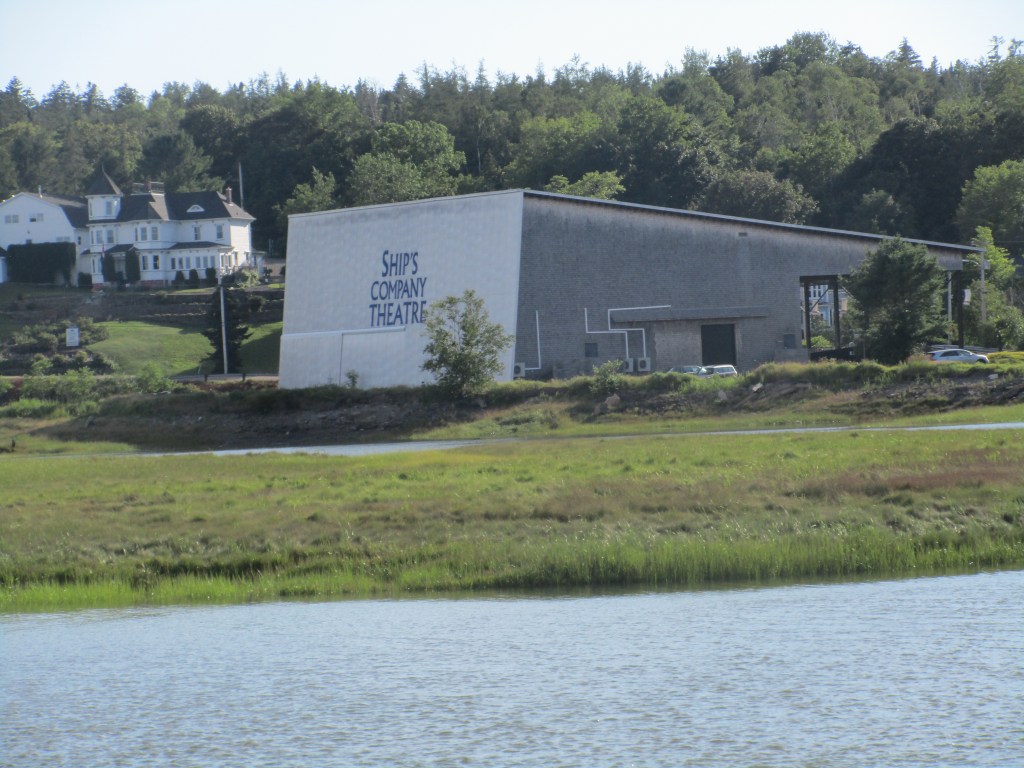
There is the Ship’s Company Theatre drawing patrons from all parts of the province with a cast of talented locals, the ever popular Fundy Geological Museum, the Ottawa House Museum, once the summer home of Sir Charles Tupper one of Canada’s prime ministers, a golf course, and Partridge Island which really isn’t an island as it’s connected by a causeway to the town/village. For outdoor enthusiasts, there are hiking trails, a beach for fossil hunting , and guided tours either by foot or by boat.
The following day which would be my last, dawned as a perfect summer day. I had so much more to see so got off to an early start beginning with the Geological Museum on the edge of town just before the causeway linking it to Partridge Island. I wanted to find out what Nova Scotia looked like millions of years ago, more about the colliding continents, and the prehistoric creatures and dinosaurs who roamed our earth.
It’s mind boggling that we can trace the beginning of life on earth to more than 45 million years ago. Scientists figure our earth has gone through five extinctions and I wasn’t surprised to find out that we are now in our sixth. A perfect museum for all ages, you can learn more by clicking on the following link http://www.novascotia.com
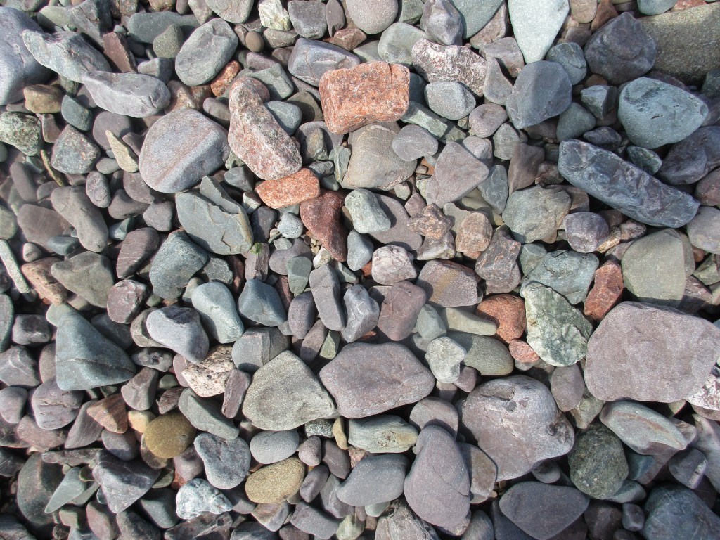
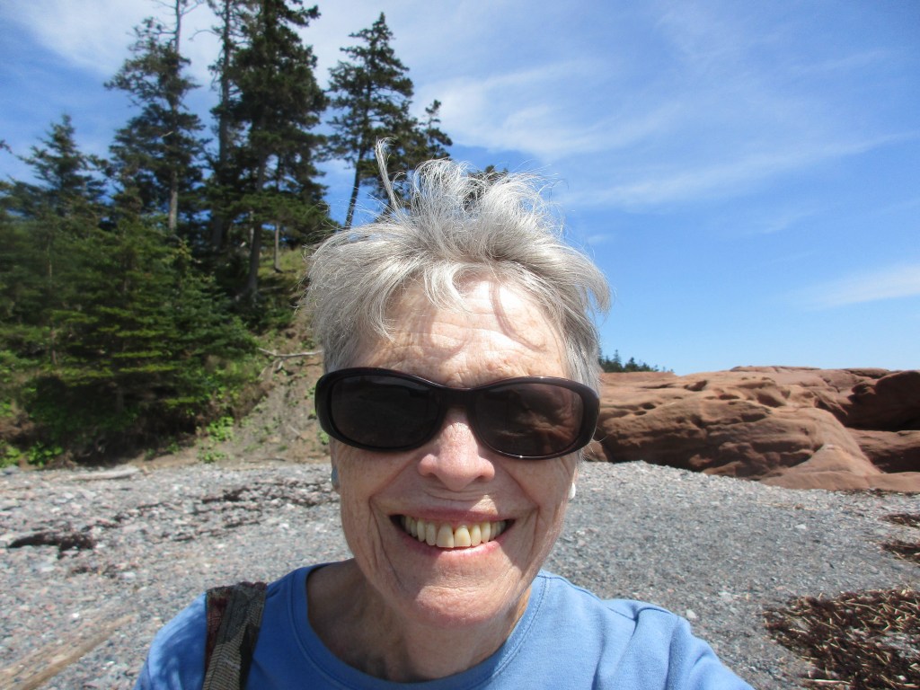
Having enough information crammed into my brain and seeing that the tide was on its way out, I decided to do a bit of beach combing. What an opportunity to look for some fossils! Minerals, stones, agates, some gems, such as agates and amethysts, or you might even be lucky enough to find a fossil hidden somewhere on this beach. I had read that we were only allowed to take a few as souvenirs. Such a difficult choice as I was tempted to take all of them.

Feeling the need for some more strenuous exercise after my hearty breakfast, I took the 1.5km trail over the mountain….more like a steep hill actually but in Nova Scotia we like to call them mountains….to get a good view of Cape Blomidon…remember, Gloosecap’s birth place… which looked so close to where I was just across the Basin. Benches strategically placed to capture incredible views are available for resting, as well as a lookout tower at the top of the trail, makes this a perfect walk.

Time now for another change of pace so I decided to pay a quick visit to the Ottawa House one of the province’s oldest Georgian houses which for over a century served as a country inn and general store under the ownership of the Ratchford family. Sir Charles Tupper, a well known physician, Premier of Nova Scotia, a Father of Confederation, and for a short time, Prime Minister of Canada bought this house as a summer residence.Today as a museum, it gives us a peek into Tupper’s life as well as the seafaring, lumbering, and cultural history of Partridge Island and the entire Parrsboro Shore.
After a quick snack on the veranda of this gracious old home with the fantastic view, I needed to get back on the Glooscap Trail or I would never have time to see all that I had planned. My next stop was Advocate Harbour where you can access the Cape Chignecto Park.
Basically a huge wilderness park, this is a hiker’s haven for those who are fit and have at least three days to complete the 53 km loop trail which from all reports may be too rigorous for some but definitely rewarding for its natural environment. Here you will encounter steep cliffs, deep valleys, sheltered coves, fossil remains, rare plants, and old growth forest. It can easily rival many of the trails in Cape Breton.
I had just enough time before the tide came in to walk down to the beach for a view of the red rocks and the Cobequid Fault, a remnant of the Pangea era when our continents were colliding with one another. For some time we have known that we were once joined to North Africa. Now are emerging into the Age of Pangea Ultima where the continents will again come together to form a larger land mass. All of this is explained in the museum I had visited in the morning.
With the end of the day and closing time for some places fast approaching, I had to make another decision. Would it be to continue on to Eatonville to a lookoff point where you can witness another iconic rock formation called the Three Sisters or turn back and make a quick detour on a gravel road leading to the Cap d’Or Coastal Park?
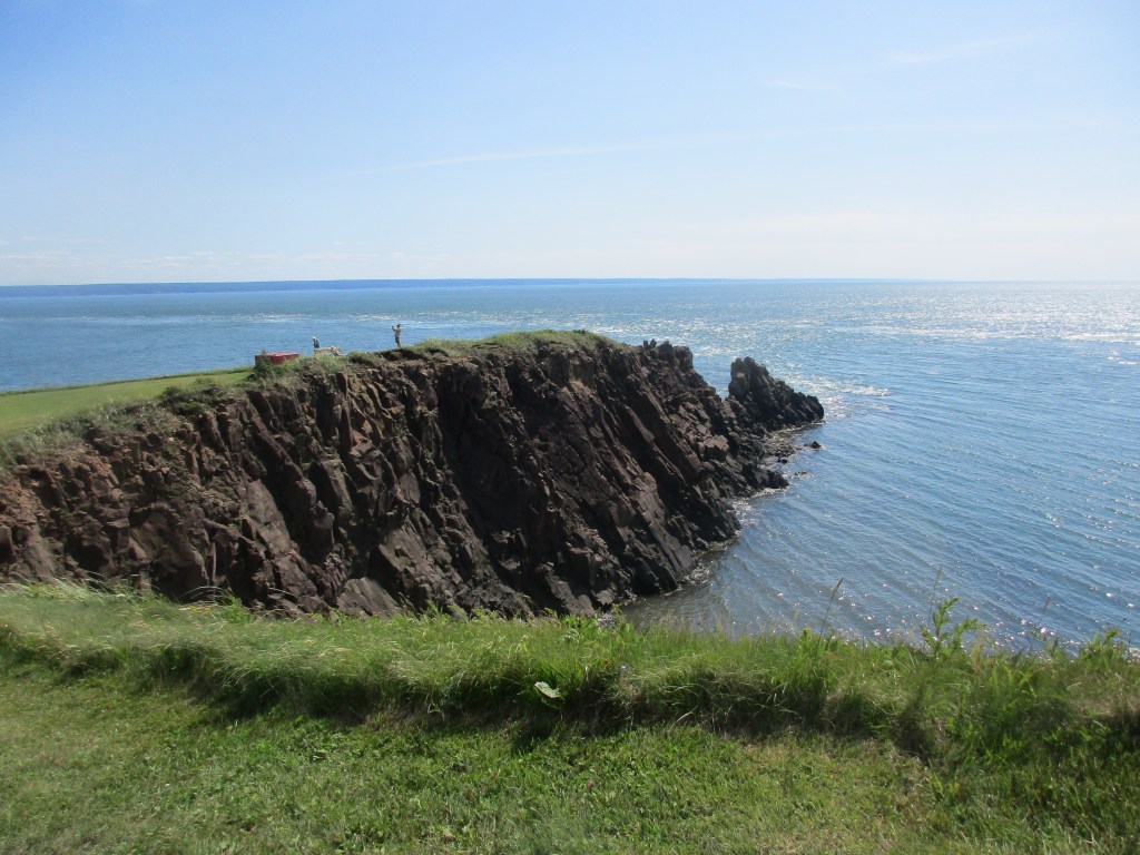
After descending a steep hill, I am greeted by another of the Bay of Fundy’s fantastic views. Here your breath might be taken away by the rugged cliffs on both sides and down below a narrow spit of land projecting out into the Bay giving you an idea of the force of the high tides that the Bay is famous for.
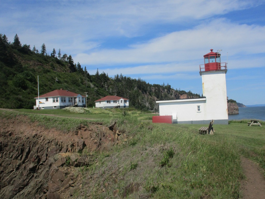
The only sign of civilization is the lighthouse and two other buildings. I found out that one of those buildings is the original home of the lighthouse keeper now operating as a rustic restaurant with 15 windows which give diners one fantastic view. According to the few people I spoke to who had all been there before, the food is freshly made from local produce with chowder and fresh fish as their specialty. However, reservations have to be made ahead of time.
Although my visit to the Parrsboro Shore was short and at times hectic trying to see everything, I came away learning so much more about my province. Here you truly get a sense of its ancient history well before the arrival of our first inhabitants… the Mi’Kmaq. I was also impressed with how well our tourism department has promoted it. Much thanks should go to the dedicated group of people who cared enough to keep pursuing for many years their UNESCO designation. They have definitely put this part of our province on the map as one more of Nova Scotia’s prime tourist attractions. Finally, let’s extend our thoughts of gratitude to Mother Earth who has gifted this entire region with so many of her wonders. There is a definite sense of peace and serenity prevailing over this land once ruled by Glooscap, the Chief of the Mi’kmaq. To my mind, it was well worth a visit for those who care about our history and our future.
